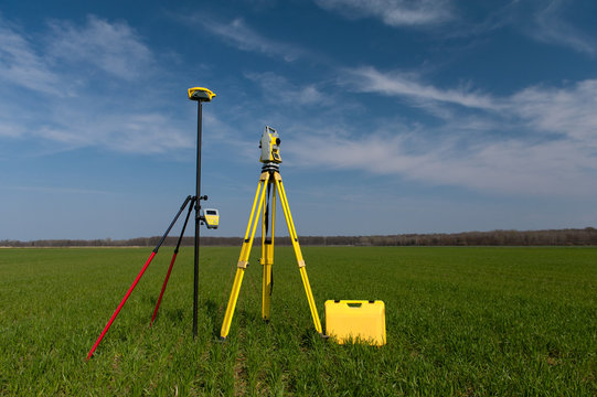
A topographic survey is a detailed mapping process used to capture the natural and man-made features of a land surface. It includes elevations, contours, trees, buildings, roads, and other visible features. This type of survey is crucial for planning construction, engineering, and land development projects. Gps (global positioning system) and total station are the two main instruments used in topographic surveys: gps provides accurate geographical coordinates using satellite signals, ideal for covering large open areas efficiently. Total station combines electronic distance measurement (edm) and angular measurement to deliver highly precise data, especially useful in areas with obstructions or where fine detail is required. Together, these tools ensure a comprehensive, accurate, and reliable representation of the terrain.
Who we are
Survey Methods & Technology
Topographic surveys are conducted using advanced equipment such as Total Stations, GPS/GNSS receivers, drones, and LiDAR systems. These technologies ensure high accuracy, efficiency, and reliable data collection, even in complex or large-scale areas.
What a Topographic Survey Includes
Ground elevations and contour lines
Natural features such as hills, rivers, trees, and drainage paths
Man-made features including roads, buildings, utilities, boundary walls, and structures