BIM Mapping & Modeling
BIM (Building Information Modeling) is a digital process used to create intelligent 3D models that represent the physical and functional characteristics of a building or infrastructure. It allows architects, engineers, and construction professionals to plan, design, construct, and manage buildings more efficiently. BIM Mapping involves integrating geospatial data with BIM models to provide location-based context. This ensures better coordination between the built environment and its surrounding terrain or infrastructure, enhancing accuracy in planning and decision-making. BIM modeling and mapping together offer a powerful platform for visualization, clash detection, quantity take-offs, and facility management, ultimately improving project efficiency, reducing costs, and minimizing errors throughout the project lifecycle.
Related Project
Roof hen an unknown printer took a galley of type and scrambled itheiro make…
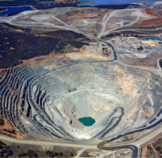
is a modern surveying method that uses drones equipped with high-precision GPS technology to…
Roof hen an unknown printer took a galley of type and scrambled itheiro make…
Drone technology is revolutionizing construction supervision by providing real-time aerial monitoring of project sites.…
Roof hen an unknown printer took a galley of type and scrambled itheiro make…